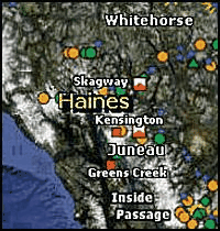
Kivalliq, located northwest of Hudson Bay and sharing a border with the Northwest Territories and Manitoba, is the heart of Nunavut's gold country. This central region of the territory is also the home of Nunavut's sole operating mine, Meadowbank.
The regions diverse geology hosts a number of mineral occurrences and deposits, particularly gold, uranium, nickel, platinum group elements, base metals, rare earth elements, and diamonds. In 2013, exploration activity in the Kivalliq Region primarily involved gold and uranium, but at reduced levels when compared to the previous three years. Exploration companies generally use Rankin Inlet and Baker Lake as staging points for their activities. The hamlets of Arviat, Chesterfield Inlet, Coral Harbour, Repulse Bay, and Whale Cove also benefit from exploration activities as the need for supplies and services grows. An estimated C$115 million was spent on mineral exploration and deposit appraisal in the region in 2013, and an additional $68 million was spent on the development of mine infrastructure, including an all-weather road from Rankin to the Meliadine gold project.
Agnico-Eagle advances gold projects
In April 2013, the hallmark one millionth ounce of gold was poured at the Meadowbank Mine, which is owned by Agnico Eagle Mines Ltd. The mine reported annual record production of 430,613 ounces of gold and 1.8 million ounces of open-pit reserves for the year. Now in its fourth year of production, Meadowbank is an open pit operation consisting of the Portage, Goose Island and Vault deposits. Goose Island and Portage deposits and the entire infrastructure are on Crown mining leases, whereas the Vault deposit is within Nunavut Tunngavik Inc.s mineral production leases. The entire Meadowbank property consists of 66,933 hectares (165,391 acres). The mine is the companys largest gold producer and currently employs a work force of about 790 people. Exploration expenditures in 2013 were modest at about C$4 million whereas planned capital spending for mine development was C$39 million. The current mine-life of Meadowbank has been extended marginally, in part due to the optimization of the mine plan at Vault, and is now forecast to operate into 2018.
Agnico Eagle also owns the Meliadine project, which covers 55,892 hectares (138,109 acres) of Crown mineral claims 50,334 hectares (124,375 acres), Crown mineral leases 931 hectares (2,301 acres) and NTI Inuit-owned lands exploration agreements 4,827 hectares (11,928 acres). About C$80 million in total expenditures was planned in 2013 for Meliadine; this total was estimated after a C$10 million cost-saving measure announced by Agnico Eagle in July. Three quarters of this budget was allocated for road construction, ramp development, camp operations and other project support costs. The remaining exploration budget of C$20 million was devoted to an extensive drilling program which completed 79,959 meters by August. The program consisted of 26,887 meters of systematic resource conversion drilling from a network of 152 holes, 47,687 meters of exploration drilling from 156 holes at Tiriganiaq, Wesmeg/Normeg, F zone, Pump and Discovery, and 29 holes at other exploration targets which provided 5,385 meters of core. The Tiriganiaq deposit is currently defined as three kilometers in length and considered to be open to the west. The Wesmeg and Normeg deposits appear to be connected to each other for a strike length of five kilometers, and remain open to the east, west and at depth. New drilling revealed that the Wesmeg portion has similar high-grade ore shoots plunging to the east that characterize the Normeg and Tiriganiaq deposits. Favorable results from deep drilling at the Pump, F Zone and Discovery deposits have added expansion potential at depth.
During the summer of 2013, AEM completed the 23-kilometer (14 miles), all-weather access road connecting the community of Rankin Inlet to the property. This required the construction of three bridges, including one across the Meliadine River. The road will significantly reduce supply transportation costs for exploration and development activities at the established camp that accommodates up to 200 people. A permanent cover was installed and completed in the third quarter over the portal entrance to the underground ramp. Plans in fourth quarter include re-opening the underground workings and constructing a 150-200 meters extension onto the existing decline.
Meliadine is currently in the permitting phase for the development of a mine. Activities in 2014 will focus on further exploration drilling on the property and extension of the underground exploration ramp from which deep exploration and conversion drilling of the Tiriganiaq and Wesmeg/Normeg zones will occur.
Although proposed expenditures for 2014 were reduced to C$45 million from $80 million, Agnico announced intentions for continued efforts to advance the project over the next few years. This work could lead to the initial start-up of a mine in 2018, pending the outcome of the environmental review and regulatory processes. If Meliadine goes into production, it may surpass Meadowbank Mine as Agnico Eagles largest gold producer.
Progress at other gold projects
The Kiyuk gold project is located in the southwestern Kivalliq region, and covers about 61,935 hectares (153,041 acres) of Crown land. The property includes several prospects: Rusty, Gold Point, Cobalt, Amundsen, North Snake, Bancroft, Rasmussen, and Anderson. In 2013, Prosperity Goldfields Corp. ran a winter drill program, with a total of 4,427 meters drilled in 20 holes. Notable results from the drilling include 35.9 meters of 4.95 g/t gold from the Rusty zone, which remains open to the east-southeast and at depth. The company followed up on the drilling results in the summer of 2013 with a short field program focused on re-logging of the previously drilled core to determine which of the several hydrothermal vein systems on the property hosts the gold mineralization. This re-logging work determined that the semi-massive sulphides and magnetite-rich breccia host the highest gold grades found to date. The company also completed legal surveying at three of its claims to start the process to convert the claims to leases.
Northquest Ltd. more than doubled its mineral tenure in 2013 over the Pistol Bay property, which now covers 90 kilometers (56 miles) of a two-kilometer (1.24 miles) -wide corridor of the Rankin-Ennadai greenstone belt. The Pistol Bay project consists of 104 mineral claims totaling 86,150 hectares (212,877 acres) owned by Northquest.
In the spring of 2013, the company completed construction of an all-season camp to support ongoing gold exploration work, now in its third consecutive year. The 2013 exploration program consisted of C$5 million in planned expenditures, including ground geophysics, geological field work, and diamond drilling.
Two previously-flown airborne geophysical surveys were used to guide follow-up ground surveys, done in 2013, for the purpose of determining the location of future diamond drilling. A 30.6 line-kilometers ground EM survey was completed at the Bazooka target and a 21.7 and 16.3 line-kilometer induced polarization/resistivity grid survey, were executed for the Sako and Vickers targets, respectively.
Systematic mapping and prospecting was carried out across the length of the project area to follow-up on gold-bearing samples and to identify new occurrences. Nine target areas, Barrett, Colt, CZ, Defender, Kimber, Purdey, Sako Grid, Tikka, and Webley, returned assay results from grab samples with anomalous gold values as high as 87.2 g/t. Highlights from the 2013 exploration program include several new gold occurrences discovered along the 90 kilometers (56 miles) length of the property.
Substantial uranium activity
Kivalliq Energy Corp. released an updated NI 43-101-compliant resource update for the Angilak Property in early 2013 comprising the Main, Western and Eastern Extension, J4, and Ray zones of the Lac 50 Trend deposit. The Angilak project comprises one IOL subsurface parcel (RI-30) surrounded by 139 Crown mineral claims, with a total combined area of 137,702 hectares (340,262 acres). Exploration on the project is focused along the Lac 50 Trend, situated at the northern margin of the Angikuni sub-basin of the Baker Lake Basin. Uranium mineralization occurs as fracture-controlled pitchblende with sulphides chiefly hosted in graphitic, chloritic tuffaceous metasediments of the Baker Lake Group.
Using a cut-off grade of 0.2 percent U3O8 and including results from diamond drilling in 2012, the company added 60 percent to its previous resource estimate. The inferred uranium resource has been revised to 2.83 million metric tons, grading 0.69 percent U3O8 for a total of 43.3 million pounds of uranium. Using the same uranium cut-off grade, the combined deposit has the potential to be a polymetallic producer with inferred mineral resources of 1.88 million ounces of silver, 10.4 million pounds of molybdenum, and 15.6 million pounds of copper.
An exploration budget of C$4.8 million was allocated to the Angilak project for 2013. Compared to previous years, the company completed a modest 14-hole drilling program with 2,101 meters of diamond drilling, bringing the total drilled on the property since 2008 to 89,530 meters. The exploratory drilling led to the discovery of a new prospective area, the J1 zone located between the Eastern Extension and J4 zones. Seven holes intersected the J1 EM conductor, and four drill holes tested the ML conductor. Mineralization occurs in association with carbonate veins hosted in sheared and hematized sulphide-bearing graphitic tuffs within a thicker sequence of basalt and gabbro. Assay results from the most significant intersection at J1 yielded 1.06 percent U3O8 and 0.28 percent copper over a true width of 0.3 meters at a vertical depth of about 60 meters (13-J1-002).
In addition to new drilling, 984 line-kilometers of geophysical surveying, geological mapping, prospecting, and environmental studies were completed on the property. Geochemical analyses of 1,538 soil samples returned anomalous uranium-in-soil values from 387 of those samples.
Some of the anomalous samples were collected 600 meters from previous drill holes with known mineralization near the Blaze, Spark, Pulse and ML zones. A large anomalous zone measuring 500 meters wide by 2,600 meters long at the Hot target area yielded 2,880 parts per billion uranium, the highest value returned to date for uranium in-soil in the Lac 50 Trend. The resulting anomalous zones, combined with their spatial association to EM conductors, will help to prioritize future drill targets. Independent metallurgical tests carried out on the Lac 50 Trend deposits during the past year yielded encouraging preliminary results.
In October 2013, the company further expanded its interest in the Kivalliq region by entering into an agreement with Pacific Ridge Exploration Ltd. to acquire 100 percent ownership of the mineral rights (excluding diamonds) on the Baker Basin Uranium property. This agreement includes results from proprietary exploration work, with a value of $7.1 million, previously completed on the claims. The 95-claim property covering 93,993 hectares (232,257 acres) lies 60 kilometers (37 miles) south of the community of Baker Lake. Multiple structurally controlled targets were discovered from exploration drilling around Bisset Lake by Pacific Ridge in 2006 and 2007.
The most advanced uranium project in the Kivalliq regions is Areva Resources Canadas Kiggavik project. Following up on its C$8.7 million exploration program in 2012 in which 11,858 meters of diamond drilling was completed at its Kiggavik project west of Baker Lake, Areva Canada continued work at Nunavuts most advanced uranium project. The company drilled 10,593 meters of drilling in 39 holes in 2013, and completed 463 line-kilometers of ground geophysics on 10 grid areas to further outline deposit resources, extend areas of known mineralization, and test geophysical targets. Environmental baseline studies and wildlife monitoring are ongoing in the project area. Project expenditures or results for 2013 have not been released by the company.
Areva also received a technical review in 2013 from the Nunavut Impact Review Board of its draft environmental impact statement and responded to comments. If the proposed C$2.1 billion project is approved, construction could begin in 2017 and production could start in 2020 from three open pits developed in succession and would require a work force of up to 600 people during the estimated 14-year life of the project. Areva is currently preparing a final EIS, expected by September.
The 122,713-hectare (303,224 acres) Aberdeen and 112,623-hectare (278,271 acres) Turqavik properties located in the Thelon Basin are owned by Cameco Corp. In 2012, the company relocated and constructed a new exploration camp and fuel tank farm on the south shore of Aberdeen Lake to support long-term activities on the advancing projects.
Several prospective targets in this part of the basin have been outlined with ground EM and gravity surveys since 2006 and many have been subsequently tested by diamond drilling. Previously unreported exploration activities carried out in 2012 included 33 diamond drill holes which totaled 9,564 meters at Tatiggaq, Qavvik, Ayra, Sandbould, Judge, Sissons and Mammoth uranium targets. Veins and fracture-hosted ore zones contain disseminated to massive pitchblende along distinct oxidation-reduction boundaries over wide intervals at depths between 80 meters and 180 meters. Noteworthy results from Tatiggaq returned grades of 0.43 percent U3O8 over a length of 54.2 meters (TUR-052B); 0.93 percent U3O8 over 9.0 meters (TUR-056); and 1.17 percent U3O8 over 6.1 meters. Uranium mineralization at Tatiggaq yielded some of the highest grades in the area of up to 24 percent U3O8 in narrow 10-30 centimeters intercepts from drill core.
The company reduced greenfields exploration for 2013 and focused on surveying 66 Turqavik claims for conversion to mineral leases. Field-based geological research projects were carried out, aimed at a structural investigation and geochemistry study of the Qavvik-Tatiggaq Trend, and other studies on the local Quaternary geology.
Interest in VMS, diamonds projects
The ATLAS project consists of 13 claims totaling 10,113 hectares (24,989 acres) hosting two stratiform zinc, silver, and copper-bearing volcanogenic massive sulphide exploration targets; ATLAS-1 and ZAC (20 kilometers or 12.4 miles) northeast of ATLAS-1). ATLAS-1 is manifested as a 1.5 km-long continuous magnetic, electromagnetic (EM), and gravity signature with exposures of massive sulphides occurring over a distance of 500 meters.
Encouraging results reported from the limited exploration work in 2012 prompted an exploration program in 2013.
The drilling program in 2013 at the ZAC occurrence consisted of five drill holes, totaling 1,306 meters. The aim was to further explore the occurrence at depth and along strike, to evaluate the economic potential of the target, and to test associated geophysical anomalies. Results confirmed the presence of a VMS setting at ZAC, with 110 m of disseminated and stringer sulphides, including chalcopyrite in one hole (ZAC-13-05) and 4.8 meters of massive sulphides in another drill hole (ZAC-13-01). Assay results are pending.
The company plans to follow up in 2014 with further drilling to evaluate the extent of the mineralization at ATLAS-1 and to test the Silty Lake geophysical anomaly identified in an EM survey.
North Arrow Minerals Inc. acquired the Luxx project in August 2013. The project area covers about 40,400 hectares (99,828 acres) and consists of three prospecting permits. The project is part of an option agreement with Anglo Celtic Exploration Ltd., along with the Mel diamond project in the Qikiqtani region.
The Luxx property is located about 20 kilometers (12.4 miles) from the known Churchill kimberlite occurrences near Chesterfield Inlet. North Arrow Minerals is investigating unexplained trains of kimberlite indicator minerals (garnet and ilmenite) identified from hundreds of till sample results published in assessment report data. The company conducted an airborne magnetic survey of the property and completed a till sampling program near prospective target areas to better define the types of indicator minerals. Results of indicator mineral analyses and aeromagnetic survey data will be used to prioritize areas for follow-up work in 2014.
In April 2013, North Arrow Minerals Inc. acquired the right to earn an 80 percent interest in the Qilalugaq diamond property situated north of Repulse Bay from Stornoway Diamond Corp. North Arrow Minerals needs to collect a mini-bulk sample (minimum 1,000 metric tons) from the 12.5 hectare (31 acres) Q1-4 kimberlite complex to obtain an improved diamond valuation. The company is in the planning stages for collecting the bulk sample in 2014.
Bitterroot Resources Ltd. planned to follow up on encouraging 2011 and 2013 exploration results at the Windy Gold project adjacent to the north and west of Prosperitys Kiyuk project in 2013 with a surface exploration program of prospecting, mapping, and geochemical sampling for 2013, but the program did not take place.
Other projects in the Kivalliq region that saw little or no activity in 2013 include Aura Silver Resources Inc.s Greyhound Lake Property near Baker Lake; Starfield Resources Inc.s nickel-copper-cobalt-platinum-palladium VMS occurrence at Ferguson Lake, which the junior attempted to sell in 2013 to Canadian North Resources and Development Corp. after Starfield filed for protection of its assets under Part 3 of Canadas Bankruptcy and Insolvency Act; the Nanuq and Nanuq North diamond projects investigated by Peregrine Diamonds Ltd., the latter in a joint venture agreement with Bluestone Resources Inc.; Adamera Minerals Corp. (formerly Uranium North Resources Corp.) gold prospect at Mallery Lake southwest of Baker Lake, its Esker, Angikuni gold and Nowyak properties in the Yathkyed greenstone belt west of Arviat and its Amer Lake uranium property ; Anconia Resources Corp.s RB gold property northwest of Whale Cove; Uru Metals Ltd.s Nueltin Lake gold-uranium project near the Manitoba border; NexGen Energy Ltd.s Thelon Basin uranium project, formerly owned by Mega Uranium Ltd.; Forum Uranium Corp.s North Thelon project; Cache Exploration Inc.s Nunavut Rare Earth project; and Ridgemont Iron Ore Corps. Maguse River iron project north of Arviat.